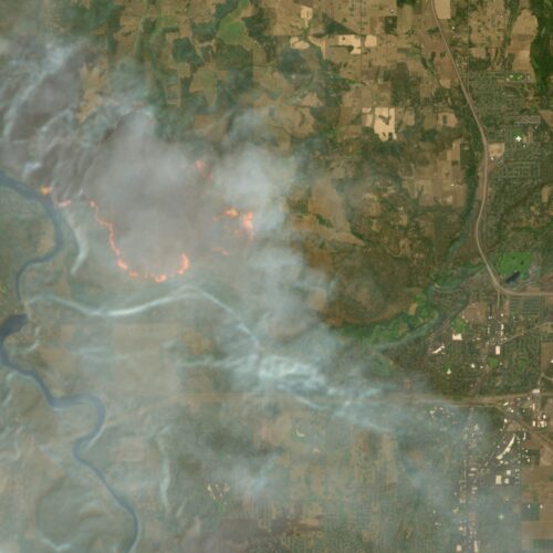
Europe's free and open satellite imagery service has made it easier for anyone to track wildfires across the globe, thanks to a new wildfire visualization script. The service, provided by the Copernicus Browser, offers access to the latest satellite imagery taken by the European Space Agency's Sentinel satellites for the European Union's Earth observation program.
The Sentinel-2 mission has proven particularly useful for monitoring wildfires, with its three satellites providing multi-spectral imaging at resolutions as granular as 10 meters in visible light and near-infrared bands. Prior to the update, the Copernicus Browser offered 10 default visualization layers using different combinations of spectral bands.
As of August 4, the Copernicus Browser has added a new "wildfires" visualization layer for Sentinel-2 imagery. This layer allows users to easily identify active fires, burning vegetation, and burned landscapes. By clicking on this layer while viewing a wildfire location, users can see active fires highlighted in white or yellow, burning vegetation in red, and burned landscapes in dark brown or black.
This development is expected to aid in the tracking and monitoring of wildfires, which have been afflicting communities worldwide. The Copernicus Browser's free and open access to satellite imagery makes it a valuable resource for individuals and organizations looking to stay informed about wildfire activity.
The new "wildfires" visualization layer is a significant update to the Copernicus Browser, building on a wildfire visualization script that originated nearly a decade ago. With this addition, the service becomes an even more powerful tool for monitoring and responding to wildfires.
The European Space Agency's Sentinel satellites and the Copernicus Browser play a crucial role in the European Union's Earth observation program. By providing free and open access to satellite imagery, the program aims to support a wide range of applications, from environmental monitoring to disaster response.
With the new "wildfires" visualization layer, the Copernicus Browser is poised to make a positive impact on wildfire tracking and management, and its free and open access to satellite imagery will likely benefit communities and organizations around the world.
<small>Source: Ars Technica — read the original story there.</small>